Search the Community
Showing results for tags 'north offset'.
Found 1 result
-
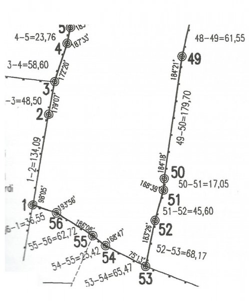
 Hi everybody, I've been reading tutorials about entering surveyor data, but still there is something I don't get it. Let's say I want to draw this scan in autocad (I already know how to enter relative xy/polar coordinates). I guess I should start the polyline at point named 1 and then enter @134.09 Segment 1-2 is visible less than 90º north, but even if I draw a visual aproximation angle for 1-2 to start de drawing, how would I then add the second segment 2-3 with the new bearing respect 1-2? How would I get a true to scan polygone? I will be gratefull of there is any explanation/example. Thanks. Paul