Search the Community
Showing results for tags 'z coordinates'.
Found 3 results
-
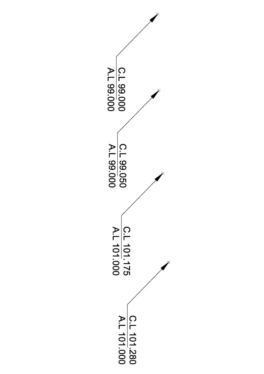
 Hi Everyone, i,m looking for LISP Program that will display Z value of 3D points as A.L=0.000 (Asphalt Level) and prompt for height between Asphalt level and top of curbstone levels because its varies and display as C.L=0.000 (Top of Curbstone level) on screen. i have a lot of data to process. for format please see the attached image.
-
Hello, Could you help me with the following question? I would like to filter all the texts and multileaders at Z=0. I could solve it for texts by using the following code, but it does not work for multileaders when I simply change TEXT to MULTILEADER. How could I do it? (sslength (ssget "X" '((0 . "*TEXT") (-4 . "*,*,=") (10 0.0 0.0 0.0)))) Thanks a lot, Cs.
-
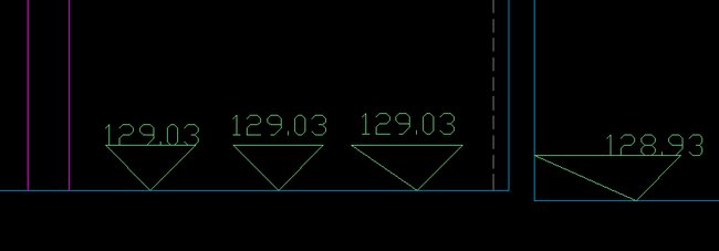
Greetings. I have a simple routine that allows to write the Z coordinates in a profile. It works, but if I'm working in an area with a small zoom, it has a behavior that distorts the triangle or does not ensure the removal of the text relative to the upper base of the triangle. If the zoom is further reduced, the triangle is not even designed. Appreciate your help for its optimization. My knowledge is limited. There are not enough to resolve the difficulty.. ;; (defun c:LEVZ(/ factesc cotorig defy defyn p1 p2 p3 cotorigt x1 y1 yf z1 yfinal ) (setq factesc (getreal "INSERT SCALE FACTOR (HIGHT STANDARD 0.20): ")) (if (= factesc nil) (setq factesc 1) ) (setq cotorig (getpoint "SELECT POINT: ")) (setq defy (cdr cotorig)) (setq defyn(car defy)) (setq p1 (polar cotorig 0.785398 (* factesc 0.62))) (setq p2 (polar p1 3.141593 (* factesc 0.88))) (setq p3 (polar p2 -0.785398 (* factesc 0.62))) (command "layer" "new" "Cotas_Nível" "color" "103" "Cotas_Nível" "") (command "layer" "set" "Cotas_Nível" "") (command "_Pline" "_non" p1 p2 P3 "C") (setq cotorigt (polar p2 1.570796 (* factesc 0.05))) (setq x1 (car cotorigt)) (setq y1 (cadr cotorigt)) (setq yf (+ y1 0.05)) (setq z1 (caddr cotorigt)) (setq yfinal (list x1 yf z1)) (command "text" yfinal (* factesc 0.20) 0 (rtos defyn 2 2)) (princ) ) (prompt "\ntYPE: LEVZ")