Jump to content

Search the Community

Showing results for tags 'c3d survey'.

  • Search By Tags

    Type tags separated by commas.
  • Search By Author

Content Type


Forums

  • CADTutor
    • News, Announcements & FAQ
    • Feedback
  • AutoCAD
    • AutoCAD Beginners' Area
    • AutoCAD 2D Drafting, Object Properties & Interface
    • AutoCAD Drawing Management & Output
    • AutoCAD 3D Modelling & Rendering
    • AutoCAD Vertical Products
    • AutoCAD LT
    • CAD Management
    • AutoCAD Bugs, Error Messages & Quirks
    • AutoCAD General
    • AutoCAD Blogs
  • AutoCAD Customization
    • The CUI, Hatches, Linetypes, Scripts & Macros
    • AutoLISP, Visual LISP & DCL
    • .NET, ObjectARX & VBA
    • Application Beta Testing
    • Application Archive
  • Other Autodesk Products
    • Autodesk 3ds Max
    • Autodesk Revit
    • Autodesk Inventor
    • Autodesk Software General
  • Other CAD Products
    • BricsCAD
    • SketchUp
    • Rhino
    • SolidWorks
    • MicroStation
    • Design Software
    • Catch All
  • Resources
    • Tutorials & Tips'n'Tricks
    • AutoCAD Museum
    • Blocks, Images, Models & Materials
    • Useful Links
  • Community
    • Introduce Yourself
    • Showcase
    • Work In Progress
    • Jobs & Training
    • Chat
    • Competitions

Categories

  • Programs and Scripts
  • 2D AutoCAD Blocks
  • 3D AutoCAD Blocks
  • Images
    • Backgrounds

Find results in...

Find results that contain...


Date Created

  • Start

    End


Last Updated

  • Start

    End


Filter by number of...

Found 3 results

  1. I'm tying to create custom Coordinate System in C3D 2012 with datum parameters (Dx, Dy, Dz, Rx, Ry, Rz and scale), but during the creation process (thru MAPCSCREATE function) I don't get anywhere to input this values. As you can see on screenshot, TOWGS parameters are all "0". Only way to form some kind of datum with parameters is creating Geodetic Transformation, but I can't link/import that in my CS definition I would appreciate any help
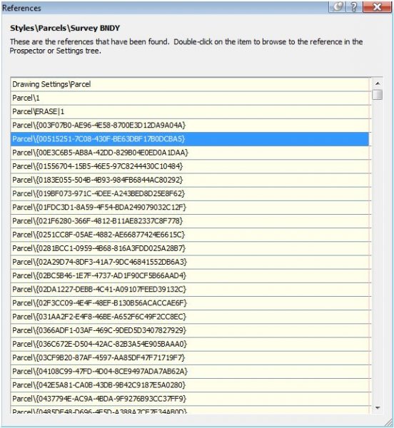
  2. I'm having problems deleting "ghost' parcels in my drawing. Please help me resolve this problem. I have attached a screen shot of my issue. I have deleted all my sites but these parcels are still in the drawing. Your assistance is greatly apprciated. Thanks
  3. How can I adjust labels on a survey line?
×
×
  • Create New...