Jump to content

Search the Community

Showing results for tags 'cogo'.

  • Search By Tags

    Type tags separated by commas.
  • Search By Author

Content Type


Forums

  • CADTutor
    • News, Announcements & FAQ
    • Feedback
  • AutoCAD
    • AutoCAD Beginners' Area
    • AutoCAD 2D Drafting, Object Properties & Interface
    • AutoCAD Drawing Management & Output
    • AutoCAD 3D Modelling & Rendering
    • AutoCAD Vertical Products
    • AutoCAD LT
    • CAD Management
    • AutoCAD Bugs, Error Messages & Quirks
    • AutoCAD General
    • AutoCAD Blogs
  • AutoCAD Customization
    • The CUI, Hatches, Linetypes, Scripts & Macros
    • AutoLISP, Visual LISP & DCL
    • .NET, ObjectARX & VBA
    • Application Beta Testing
    • Application Archive
  • Other Autodesk Products
    • Autodesk 3ds Max
    • Autodesk Revit
    • Autodesk Inventor
    • Autodesk Software General
  • Other CAD Products
    • BricsCAD
    • SketchUp
    • Rhino
    • SolidWorks
    • MicroStation
    • Design Software
    • Catch All
  • Resources
    • Tutorials & Tips'n'Tricks
    • AutoCAD Museum
    • Blocks, Images, Models & Materials
    • Useful Links
  • Community
    • Introduce Yourself
    • Showcase
    • Work In Progress
    • Jobs & Training
    • Chat
    • Competitions

Categories

  • Programs and Scripts
  • 2D AutoCAD Blocks
  • 3D AutoCAD Blocks
  • Images
    • Backgrounds

Find results in...

Find results that contain...


Date Created

  • Start

    End


Last Updated

  • Start

    End


Filter by number of...

Found 2 results

  1. We get survey points for water and sewer lines. In the record drawing, for selected COGO points, we would like to pull the station value for each point and incorporate it in the label style for the point. A colleague came up with a clunky sort of process: create an alignment offset label that coincides with the survey point, then pull the information from that label into the point label. I've been trying to find a way to combine those two steps, so that the point label automatically incorporates the station value. If your answer is "a LISP function," that's all you need to say, I can write LISP. I'm just hoping I overlooked a more direct solution.
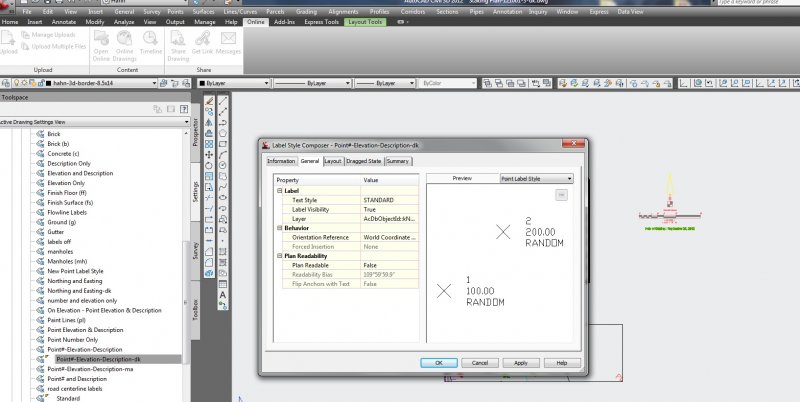
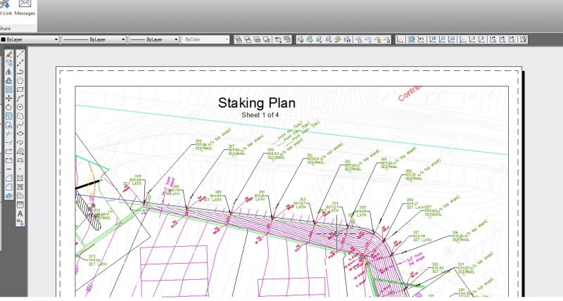
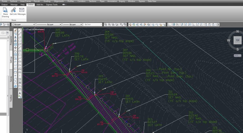
  2. Hi All, I have a dwg that looks great in modelspace, however I created a couple paperspace layouts and then used AlignSpace to rotate to those views. The problem is that my point label style rotates the point labels based on the alignspace rotation. I looked into the point label settings and changed the orientation reference to the World Coord. Sys., but it does not help the points rotate correctly. (world reference is the goal) Any thoughts? Please see attached images.
×
×
  • Create New...